Geologic Mapping and Hydrogeologic Investigation
Research Info
Student: Matt Rhoads
Advisors: Dave Malone and Eric Peterson
Hydrogeology students have a rich history of integrating 3D geologic mapping with hydrogeologic modeling. Generally, these investigations have focused on buried channel aquifers or outwash aquifers created during recent glaciation. The objectives of the research are to define the geometry of the channels, to map the sediments that fill the channels, to measure aquifer properties of the coarse-grained sediments, and to examine the interaction of aquifers with surface water bodies.
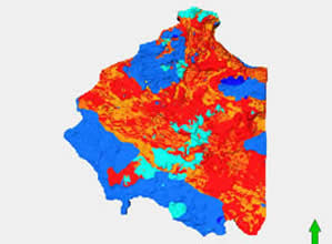
Matt research focuses on the hydrogeologic evolution of the Kishwaukee bedrock channel in northern Illinois. The channel was first formed in response to Mesozoic deformation and was eventually buried during Quaternary glacial action. Today, the Kishwaukee channel serves as a source of industrial aggregates and contains a productive groundwater system. The objectives of his project are to determine the subsurface geometry of the channel, map the glacial sediments that fill it, and begin to develop a hydrologic framework for the feature. To meet these objectives, Matt is using a combination of geophysics and geostatistics to develop 3D geologic model of the Kishwaukee channel. Modeling the bedrock structure and lithologies present will serve two key purposes: First, it will provide a framework for future hydrologic investigation and second, it will help improve the resolution of preglacial history in Illinois.
Recent related publications include:
- Avalos, E., Malone, D., Peterson, E. W., Anderson, W. P., and Gehrels, R., 2016, Two-Dimensional Seismic Refraction Tomography of a Buried Bedrock Valley at Hallsands Beach, Devon, UK: Environmental Geosciences, v. 23, no. 4, p. 179-193, doi:10.1306/eg.07131615014.
- Carlock, E.*, Peterson, E. W., and Malone, D. H., 2016, Three-dimensional geologic modeling and groundwater flow modeling above a CO2 sequestration test site: Open Journal of Modern Hydrology, v. 6, no. 3, p. 182-193, doi:10.4236/ojmh.2016.63015.
- Lau, J.*, Malone, D. H., Thomason, J., and Peterson, E., 2016, Modeling the Sediment Fill of the Upper Troy Pre-Glacial Bedrock Valley, McHenry County, Illinois, USA: Journal of Geoscience and Environment Protection, v. 4, no. 6, p. 107-122, doi:10.4236/gep.2016.46010
- Lau, J.*, Thomason, J. F., Malone, D. H., and Peterson, E. W., 2016, Three-Dimensional Geological Model of Quaternary Sediments in Walworth County, Wisconsin, USA: Geosciences, v. 6, no. 32, p. 14, doi:10.3390/geosciences6030032.
- Seipel, L.*, Peterson, E. W., Malone, D. H., and Thomason, J. F., 2016, Role of multiple high-capacity irrigation wells on a surficial sand and gravel aquifer: Journal of Geoscience and Environment Protection, v. 4, no. 5, p. 43-53, doi:10.4236/gep.2016.45005.
- Carlock, D. C.*, Thomason, J. F., Malone, D. H., and Peterson, E. W., 2016, Stratigraphy and Extent of the Pearl-Ashmore Aquifer, McHenry County, IL, USA: World Journal of Environmental Engineering, v. 4, no. 1-6, p. 6-18, doi:10.12691/wjee-4-1-2.
- Willems, B.A.*, Malone, D.H., and Pugin, A., 2007, Geologic characteristics of the central stretch of the Ticona Channel, north-central Illinois, Environmental Geosciences, v. 14, no. 3, p. 123-136.